✦Starry Memory
Which constellations are visible from Oklahoma City?
Use the free local tool
This page provides a result prefilled with the place and coordinates. The calculations and phone gyroscope work without an order; the HD poster remains optional. See the Oklahoma City constellation table
A latitude-based guide with transit altitude, season and circumpolar status
Not every constellation rises from every latitude. This guide compares the representative declination of well-known constellations with the latitude of Oklahoma City. It shows which patterns can clear a practical horizon, how high they culminate and which northern or southern groups stay circumpolar.
Why choose Starry Memory
- Latitude, not guesswork — 20 catalogue constellations clear the 12° transit-altitude screen at the latitude of Oklahoma City.
- GPS · IANA reference — Exact reference: Oklahoma, 35.4676° N, 97.5164° W, America/Chicago.
- Free tool — The city-specific tool works free in the browser and does not create an order.
- Transparent limits — Weather, light pollution and local obstructions are stated as limits instead of being hidden.
From Oklahoma City, latitude decides how high each familiar pattern can climb above an ideal horizon. Its verifiable starting point is GeoNames 4544349, 35.4676° N, 97.5164° W, in timezone America/Chicago.
Latitude-screened constellations for Oklahoma City
Each entry below gives an approximate maximum altitude at meridian transit and a practical season; an asterisk means circumpolar in this simplified centroid model: Ursa Major: 69.5°, all year *; Cassiopeia: 65.5°, all year *; Draco: 60.5°, all year *; Cepheus: 55.5°, all year *; Ursa Minor: 48.5°, all year *; Lyra: 89.5°, summer; Andromeda: 87.5°, autumn; Cygnus: 85.5°, summer; Boötes: 84.5°, spring; Auriga: 83.5°, winter; Perseus: 80.5°, winter; Gemini: 76.5°, winter; Taurus: 72.5°, winter; Leo: 69.5°, spring. This is a planning guide, not a promise that every star will be visible from a bright street. Date, hour, local obstructions and light pollution still matter. The live sky tool performs the date-specific projection that a static latitude table cannot.
Oklahoma City's verifiable local record
Calculation identity: GeoNames 4544349 · city Oklahoma City · region Oklahoma · country United States · national selection rank 22 · reference population 681,054 · source elevation 366 m. Spatial fingerprint: latitude 35.46756 · longitude -97.51643 · north hemisphere · timezone America/Chicago · celestial-pole altitude 35.5°. Seasonal signature: longest night in December, 14 h 23 · shortest night in June, 9 h 37 · range 4.77 hours. Meridian star markers: Ursa Major 69.5° * · Cassiopeia 65.5° * · Draco 60.5° * · Cepheus 55.5° * · Ursa Minor 48.5° * · Lyra 89.5°. Nearby catalogue cities: Tulsa 157 km · Wichita 248 km · Plano 282 km. First regional eclipse shortlist: 2027-02-20 Penumbral lunar eclipse 23:14 UTC · 2027-08-17 Penumbral lunar eclipse 07:14 UTC · 2028-01-12 Partial lunar eclipse 04:14 UTC. Together these values form the local evidence record for the “constellations” page; they change with place and remain separate from real weather.
Oklahoma City compared with nearby catalogue cities
1. Oklahoma City → Tulsa: 157.2 km · Δlat +0.686° · Δlon +1.524° · Δpole +0.7° · timezone America/Chicago = America/Chicago · longest night December 14 h 27 | 2. Oklahoma City → Wichita: 247.9 km · Δlat +2.225° · Δlon +0.179° · Δpole +2.2° · timezone America/Chicago = America/Chicago · longest night December 14 h 35 | 3. Oklahoma City → Plano: 282.4 km · Δlat -2.448° · Δlon +0.818° · Δpole -2.5° · timezone America/Chicago = America/Chicago · longest night December 14 h 10. Monthly night comparison with the nearest catalogue reference — January: Oklahoma City 14 h 09 / Tulsa 14 h 12 / Δ -0.05 h · February: Oklahoma City 13 h 17 / Tulsa 13 h 19 / Δ -0.03 h · March: Oklahoma City 12 h 16 / Tulsa 12 h 16 / Δ +0.00 h · April: Oklahoma City 11 h 06 / Tulsa 11 h 04 / Δ +0.03 h · May: Oklahoma City 10 h 08 / Tulsa 10 h 05 / Δ +0.05 h · June: Oklahoma City 9 h 37 / Tulsa 9 h 33 / Δ +0.07 h · July: Oklahoma City 9 h 50 / Tulsa 9 h 46 / Δ +0.06 h · August: Oklahoma City 10 h 40 / Tulsa 10 h 37 / Δ +0.04 h · September: Oklahoma City 11 h 47 / Tulsa 11 h 47 / Δ +0.01 h · October: Oklahoma City 12 h 55 / Tulsa 12 h 57 / Δ -0.03 h · November: Oklahoma City 13 h 55 / Tulsa 13 h 58 / Δ -0.05 h · December: Oklahoma City 14 h 23 / Tulsa 14 h 27 / Δ -0.06 h. For constellation screening, latitude difference becomes a meridian-altitude difference; a small change is reported as small rather than exaggerated for local copy.
The astronomical fingerprint of Oklahoma City
Oklahoma City is represented by 35.4676° N, 97.5164° W, in Oklahoma, using the IANA zone America/Chicago. This is a mid-latitude viewpoint: the relevant celestial pole stands about 35.5° above its horizon. GeoNames record 4544349 supplies the geographic reference; its population field is 681,054 and is used for catalogue selection, not presented as a live census. The source elevation is 366 metres; terrain can hide a low object even when the geometric calculation says it rises.
Twelve monthly light estimates for Oklahoma City
The following pairs are approximate daylight / night duration around the 15th of each month: January: 9 h 51 / 14 h 09; February: 10 h 43 / 13 h 17; March: 11 h 44 / 12 h 16; April: 12 h 54 / 11 h 06; May: 13 h 52 / 10 h 08; June: 14 h 23 / 9 h 37; July: 14 h 10 / 9 h 50; August: 13 h 20 / 10 h 40; September: 12 h 13 / 11 h 47; October: 11 h 05 / 12 h 55; November: 10 h 05 / 13 h 55; December: 9 h 37 / 14 h 23. The longest estimated night in this model is December at 14 h 23; the shortest is June at 9 h 37. “Night” here is the complement of daylight on a flat horizon. Civil, nautical and astronomical twilight are not interchangeable, and weather is not predicted by this table.
What the calculation does — and does not claim
Coordinates, date and local time feed the same astronomical workflow used by the poster. The HYG catalogue provides star entries, while Astronomy Engine calculates moving bodies. The page does not claim that city-centre coordinates equal a hospital, venue or home: selecting an autocomplete suggestion replaces the shortcut with that location. It also separates astronomical geometry from weather and light pollution, so a correct map never becomes a claim that the ground-level sky was cloudless.
Free gyroscope first, optional poster second
On a compatible phone, the gyroscope turns the calculated sky into a movable window: tilt and rotate to explore, with star names shown beside key points. That experience is free. If a date deserves a keepsake, the same place can continue into the editor. The protected preview remains watermarked before payment; the €3.99 purchase unlocks the 4960 × 7016 px, 300 DPI file. Physical formats appear only when availability, delivery supplement and timing can be checked for the destination. Checkout is in euros; the card issuer shows the current conversion to US dollars (USD).
Frequently asked questions
Why use a 12° altitude threshold?
It removes patterns that only graze an ideal horizon. 20 catalogue groups pass that screen here, but local hills and buildings can require a higher threshold.
Can I replace the centre of Oklahoma City with an exact address?
Yes. Choose the intended autocomplete suggestion; its coordinates replace the city shortcut. Unselected free text is never silently sent to a default city.
Is the Oklahoma City tool free?
Yes. The local calculation, tables and gyroscope exploration can be used without payment. Only the unlocked HD poster is paid.
Does this guarantee clear-sky visibility?
No. The calculations describe geometry. Cloud, terrain, buildings and light pollution can change what a person sees from the ground.
Do I have to buy a poster?
No. The tool stands on its own. If wanted, the watermark-free 4960 × 7016 px, 300 DPI file costs €3.99. Checkout is in euros; the card issuer shows the current conversion to US dollars (USD).
See the Oklahoma City constellation table
Turn a night under the stars into a gift
Keep exploring for free. When a night means something to you, choose how to remember it.
Keep the whole sky
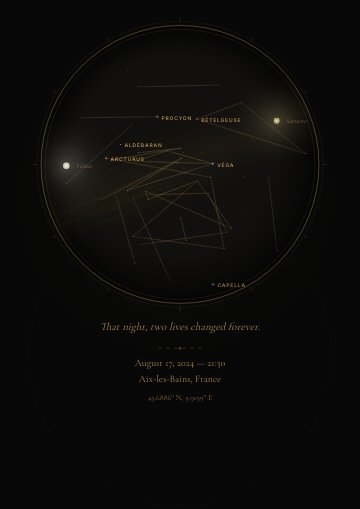
A first date, a birth, a wedding or tonight: create a star map for your chosen place and date, with your own words.
Example design — personalise your own sky in the creator.
Give one star a special meaning
Choose a catalogue star and personalise its PDF certificate. After purchase, your private order link opens a guide to its calculated direction in the sky.
A compatible phone is recommended for gyroscope guidance. Visibility depends on your location, time, weather and the star’s brightness. The certificate records an entry in the private Starry Memory registry, not ownership of the celestial body.
See also
← Back to Starry Memory